

Nant Ffrancon, Snowdonia taken by Einir Leigh
Finally we get a rest from the very wet weather as we go into a northerly airflow. Overall it looks to be a drier week, as low pressure gives way to a ridge of high pressure later on in the week. It will feel a lot colder this week as strong north westerly winds take charge. I can’t promise a totally dry story either as we will see some wintry showers with widespread frost. There is also more chance of seeing some brightness but It's certainly time to wrap up this week!
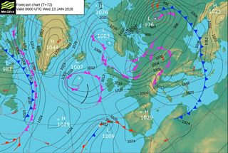
Pressure chart for Wednesday 13 January
Monday is a transitional day between the milder and colder conditions. We will see some scattered showers for the afternoon mixed with brighter sunny spells. The winds will be light and variable with highs of 5-8°C. On Monday night the winds flip round to a north westerly and become stronger with gales possible along the north-west coast. The wind should stop widespread frost from forming in most places, but in sheltered areas in the east we could see a touch of frost.

Weather chart for Tuesday 12 January
On Tuesday we'll start to feel the cold weather kicking in. Strong to gale force winds are especially likely for exposed areas in the north-west. The wind will at least take the edge off the colder temperatures. We do also have more showers to come which again could be heavy and wintry. Pembrokeshire right across to Newport should escape the worst of the showers.
It will feel even colder by Wednesday, which will see a crisp and bright start to the day. Showers forming in the west will spread across the country, these yet again, could be wintry even at lower levels. Overnight we should see a band of rain, sleet and snow spreading across the country. However, this should move through pretty quickly and not cause too many problems.
The cold theme will continue for the rest of the week and by the weekend it will feel bitterly cold, although there is a higher chance of some drier and brighter weather.

Photograph taken by John Davies