
It’s going to turn colder again over the weekend with a new influx of Arctic air spreading southwards.
Warnings are in force for snow and ice. Strong to gale force winds are expected as well with gusts over 60mph on the west coast.
Tonight will see some dry, clear weather but showers will become more widespread after midnight. Some of the showers will be heavy with sleet and snow in places. Snow is likely to settle mainly above 200m.
Strong to gale force winds will affect the west coast. The lowest temperatures inland will be around freezing with icy patches on untreated roads.
The jet stream tomorrow will lie to the west and south of the UK with much of Europe in cold air.
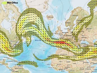
Weather map 30 January 2015
Tomorrow will bring some dry weather and sunshine but showers as well. The showers will be heavy in places with hail and sleet and snow on higher ground. It will be colder than today and windier too. Top temperatures will be 3 to 6° Celsius, with gales on the north and west coast as well as the hills and mountains making it feel bitterly cold.
Tomorrow night will be windy with further showers. There’s a warning of snow in parts of the north. Most of the snow will fall on higher ground. By the end of the night most of the country should be dry with icy patches.
Sunday will be a cold day but with some sunshine. Most of the showers will be in the west and south west and falling as hail, sleet or snow. The strong winds will slowly ease during the day with highs of 2 to 5 Celsius.
Next week it’s staying cold with a few wintry showers. There will be snow in places as well as frost and ice. During the second week of February it may turn a bit milder with Atlantic winds bringing higher temperatures.